Step 1
Snap a photo
A real-world street, a landscape, or even a screenshot of a Street View browser round.
Snap a street, a building, a landscape — or even a screenshot of a street-view round. Sherlocale tells you the country, the region, and exactly which visual clues gave it away.
Free for your first 5 location guesses. No signup needed for the first try.
Three taps. No setup. Just your photo and an answer.
A real-world street, a landscape, or even a screenshot of a Street View browser round.
Google's Gemini vision model analyzes architecture, signage, vegetation, road markings, license plates, and the sun.
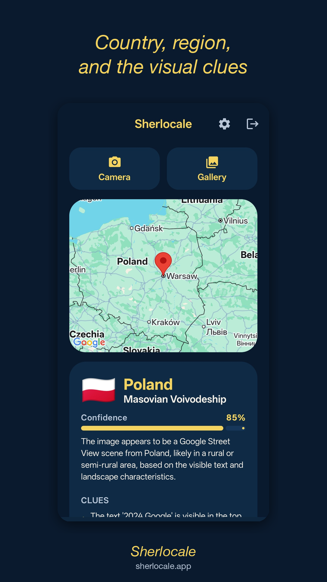
Country, region, confidence score, a map pin, and the exact list of clues the AI used to make its call.
Sherlocale handles real photos and screenshots equally well — and ignores the noise around them.
Street corners, plazas, distinctive buildings, alleys you walked once and forgot where.
Mountains, deserts, beaches, forests, fields — vegetation and terrain pin them down.
License plates, road markings, language and script on signs, driving side, bollard styles.
Photos of your monitor mid-game. We strip out browser chrome, the minimap, and the timer.
Roof shapes, window styles, balcony patterns — they leak the country and often the region.
License plate format, car model availability, and bus liveries narrow the country fast.
Spotted a place online and need to know where it is? Drop the photo in.
Stuck on a round and want a second opinion? Snap your screen and Sherlocale takes over.
"What country is this?" with a confident answer and a list of reasons why.
A road sign, a balcony, a mountain — Sherlocale has an opinion about where you saw it.
Join the closed-testing waitlist. We email you the install link the moment it goes live.